GRAHAM. (William) TRAVELS THROUGH PORTUGAL AND SPAIN,
DURING THE PENINSULAR WAR, By WILLIAM GRAHAM, Esq. WITH ENGRAVINGS. LONDON: PRINTED FOR SIR RICHARD PHILIPS AND CO. BRIDE COURT, BRIDGE STREET. [G. Sidney Printer, Strand]. 1820. De 23x15 cm. Com iv-88 pags. Encadernação recente com lombada e cantos em pele ao gosto da época. Ilustrado com 1 mapa desdobrável (23x27 cm) e 7 gravuras extra-texto. Mapa da Península Ibérica antecedendo a página de título; gravado por Neele e publicado pelo editor Richard Philips and Co. em Junho de 1820. Obra com o diário do oficial britânico William Graham - enviado para Portugal em Outubro de 1812, no final das campanhas militares inglesas – descrevendo o longo trajecto de perseguição ao exército francês em retirada desde Portugal até França – terminando a narrativa em Setembro de 1814. O autor aproveita para descrever os locais e as pessoas que contactou, dando-nos conta de como os ingleses efectuaram o contacto com a retaguarda do exército napoleónico e com as populações em fuga. No final estabelece uma comparação de atitudes entre o povo português e o povo espanhol relativamente à presença dos exércitos estrangeiros. Exemplar com margens generosas (não aparado) e com ilustrações do autor, nomeadamente: 1) Trancoso e as suas muralhas romanas; 2) Panorama do rio Tejo junto a Tomar (Almorol); 3) A marcha das tropas nas montanhas da Serra da Estrela; 4) Ruínas do castelo mouro de Moreira e Rochas naturais perto de Trancoso; 5) Os Pirenéus perto de Lezaca (gravura desdobrável); 6) Passagem do Bidassoa (gravura desdobrável com cena de batalha de Bidassoa ou de La Rhune, no País Basco, em 7 de Outubro de 1813, na qual participaram 65 mil homens do Exército Anglo-português e 25 mil espanhóis); e 7) os pastores de Landes nas suas típicas andas. Binding: recent ¾ leather bound replicating contemporary style. Illustrated with 1 folding map (23x27 cm), and 7 plates. Map of the Iberian Peninsula is preceding the title page, engraved by Neele, published by the editor Richard Phillips and Co. in June 1820. Work with the diary of the British officer William Graham sent to Portugal in October 1812 - by the end of British military campaigns and describing the long path of chasing the retreating French army from Portugal to France - the narrative ends in September 1814. The author takes this opportunity to describe the places and people he contacted, giving us an account of how the British have made contact with the rear battalions of the Napoleonic army and the people fleeing from the scene of war. At the end the author provides a comparison of attitudes among the Portuguese people and the Spanish people for the presence of foreign armies. Copy with wide margins (uncut) and with illustrations by the author, including: 1) Trancoso and its Roman walls; 2) panorama of the Tagus river near Tomar (Almorol); 3) The march of the troops in the mountains of Serra da Estrela; 4) Moorish Castle Ruins at Moreira and natural rocks near Trancoso; 5) The Pyrenees near Lezaca (folding plate); 6) Bidassoa Pass (folding plate with battle scene from La Rhune or Bidassoa, in the Basque Country, on October 7th, 1813, attended by 65.000 soldiers of the Anglo-Portuguese Army and 25,000 Spaniards), and 7) the shepherds of the Landes in his typical stilts.
Caixa de sugestões A sua opinião é importante para nós.
Se encontrou um preço incorrecto, um erro ou um problema técnico nesta página, por favor avise-nos.
Outras Sugestões
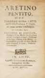
ARETINO. (Pietro)ARETINO PENTITO, CIOÉ PARAFRASI SOVRA I SETTE SALMI DELLA PENITENZA DI DÁUIDE.
Preço: €300
Ref: 2310PG010
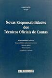
SANTOS. (Albano)NOVAS RESPONSABILIDADES DOS TÉCNICOS OFICIAIS DE CONTAS.












 English
 Binding: recent ¾ leather bound replicating contemporary style. Illustrated with 1 folding map (23x27 cm), and 7 plates. Map of the Iberian Peninsula is preceding the title page, engraved by Neele, published by the editor Richard Phillips and Co. in June 1820. Work with the diary of the British officer William Graham sent to Portugal in October 1812 - by the end of British military campaigns and describing the long path of chasing the retreating French army from Portugal to France - the narrative ends in September 1814. The author takes this opportunity to describe the places and people he contacted, giving us an account of how the British have made contact with the rear battalions of the Napoleonic army and the people fleeing from the scene of war. At the end the author provides a comparison of attitudes among the Portuguese people and the Spanish people for the presence of foreign armies. Copy with wide margins (uncut) and with illustrations by the author, including: 1) Trancoso and its Roman walls; 2) panorama of the Tagus river near Tomar (Almorol); 3) The march of the troops in the mountains of Serra da Estrela; 4) Moorish Castle Ruins at Moreira and natural rocks near Trancoso; 5) The Pyrenees near Lezaca (folding plate); 6) Bidassoa Pass (folding plate with battle scene from La Rhune or Bidassoa, in the Basque Country, on October 7th, 1813, attended by 65.000 soldiers of the Anglo-Portuguese Army and 25,000 Spaniards), and 7) the shepherds of the Landes in his typical stilts.