

Home |
Temáticas |
Catálogos |
Pedidos |
| |
|||||||
|

|
RUGENDAS. (Johann Moritz) HABITANTE DE GOYAS, QUADRO A ÓLEO PINTADO SOBRE MADEIRA. |
|
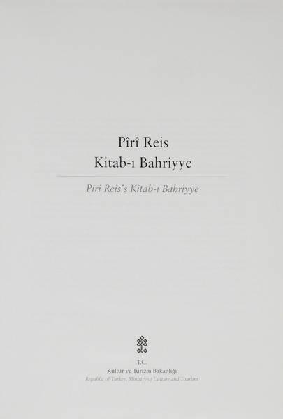
Clique nas imagens para aumentar. PÎRÎ REIS. (Hadji Ahmed Muhiddin) KITAB-I BAHRIYYETipkibasim Topkaki SarayiMüzesi Ktp., Hazine Koleksiyonu, Nr. 642. Facsimile Topkapi Palace Museum Library, Treasury Collection, Number 642. T. C. Kültür ve Turizm Bakanligi. Republic of Turkey, Ministry of Culture and Tourism. Ankara. 2014. De 32,7x22,7 cm. Com 40, págs., [ii], 426, [i] fólios. Encadernação inteira de pele a imitar o estilo otomano, com aba que protege os cortes das folhas e fecha sobre a pasta posterior, com ferros a ouro na lombada e nas pastas, em baixo relevo formando uma elaborada esquadria com decorações geométricas e florais, em especial nos cantos e com grandes florões decorativos ao centro. As folhas de guarda reproduzem belos padrões marmoreados. É da autoria de Numune Matbaasi. Ilustrado com um magnífico facsimile, fotografias de Bahadir Taskin, sobre papel couché, com uma representação exacta em todos os pormenores e cores da melhor e mais completa de todas as cópias da segunda edição (1525) actualmente existentes desta obra. As 40 páginas iniciais contêm: Prefácio de Recep Tayyip Erdogan, Primeiro Ministro da Turquia: Introdução de Ömer Çelik, Ministro da Cultura e Turismo; Estudo sobre a obra e o autor, por Fikret SaricaoGlu, Professor da Universidade de Istambul, 3 textos em turco e inglês; e um pormenorizado índice dos mapas e capítulos, em turco. Obra publicada no âmbito das comemorações do Quinto Centenário do Mapa Mundo de Piri Reis, que decorreram a partir de 2013. O Kitab-i Bahriyye - Livro de Navegação, de 1521, é um roteiro com 290 cartas desenhadas pelo autor e com o texto copiado por um excelente calígrafo, onde reuniu os seus conhecimentos sobre geografia do mediterrãneo e sobre cartografia. É a mais completa e exacta descrição do Mediterrãneo feita até esta data. Contém cartas muito rigorosas e pormenorizadas, informação detalhada das técnicas de navegação, descrições da costa do Mediterrâneo, das suas ilhas, estreitos, e golfos, assinala os lugares mais próprios para os navios se refugiarem durante as tempestades, as rotas para os portos e a forma de se aproximar de cada porto. Piri Reis (Galípoli, c. 1465 - Cairo 1553) Almirante, geógrafo e cartógrafo otomano. Muito célebre por ter sido o autor do primeiro mapa Turco, que inclui partes do continente americano. É autor de duas cartas de marear, uma delas, de 1513, muito célebre por se basear em mapas que lhe foram oferecidos por Colombo, e outra elaborada em 1528. A sua notável obra cartográfica foi realizada devido à grande esperiência e conhecimentos obtidos durante a sua longa carreira como marinheiro e Almirante, assim como á sua capacidade de estar a par dos avanços da ciência e da náutica nomeadamente dos portugueses. Era sobrinho do Almirante da Armada Otomana, Kemal Reis e começou a sua carreira, com 11 anos, ao serviço do seu tio. Entre 1499 e 1502 assumiu o comando de uma esquadrilha e até ao falecimento do seu tio em 1511 comandou esquadras nas guerras com Veneza. Em 1516 e 1517 acompanhou Selim I, na conquista do Egipto, Síria e a Palestina, tendo colaborado na tomada de Alexandria e em 1523 participou na campanha de Rodes. Em 1547 foi designado para comandar a Armada destinada a enfrentar a expansão portuguesa no Mar Vermelho, Mar da Arábia, Índico e no Golfo Pérsico. Apesar de alguns sucessos iniciais, em Aden, 1547 e Mascate, em 1551, acabou por falhar na suas tentaivas de expulsar os portuguese do Mar Vermelho e do Golfo Pérsico e voltou só com dois dos seus navios ao Cairo, onde, acusado de ter sido subornado, foi decapitado em 1553,
Illustrated with a magnificent facsimile, photographs by Bahadir Taskin, on coated paper, with an exact representation in every detail and colour of the best and most complete of all the copies of the second edition (1525) currently extant of this work. The initial 40 pages contain: a Foreword by Recep Tayyip Erdogan, Prime Minister of Turkey: an Introduction by Ömer Çelik, Minister of Culture and Tourism; a Study on the work and the author by Fikret SaricaoGlu, Professor at Istanbul University, 3 texts in Turkish and English; and a detailed index to the maps and chapters, in Turkish. Published as part of the celebrations of the Fifth Centenary of Piri Reis" World Map, which took place from 2013. The Kitab-i Bahriyye - Book of Navigation, of 1521, is a guide with 290 charts drawn by the author and with the text copied by an excellent calligrapher, where he gathered his knowledge of Mediterranean geography and cartography. It is the most complete and accurate description of the Mediterranean made to this date. Contains very accurate and detailed charts, detailed information on navigation techniques, descriptions of the Mediterranean coast, its islands, straits, and gulfs, points out the most suitable places for ships to take refuge during storms, the routes to ports, and how to approach each port. Piri Reis (Gallipoli, c. 1465 - Cairo 1553) Ottoman admiral, geographer and cartographer. Most famous for being the author of the first Turkish map, which includes parts of the American continent. He is the author of two sea charts, one in 1513, famous for being based on maps given to him by Columbus, and the other in 1528. His remarkable cartographic work was achieved due to the great experience and knowledge obtained during his long career as a sailor and admiral, as well as his ability to keep abreast of advances in science and nautical science, particularly those of the Portuguese. He was the nephew of the Admiral of the Ottoman Armada, Kemal Reis and began his career, at the age of 11, in the service of his uncle. Between 1499 and 1502 he took command of a squad and until his uncle"s death in 1511 he commanded squads in the wars with Venice. In 1516 and 1517 he accompanied Selim I in the conquest of Egypt, Syria and Palestine, collaborated in the capture of Alexandria and in 1523 participated in the Rhodes campaign. In 1547 he was designated to command the Armada to confront the Portuguese expansion in the Red Sea, the Arabian Sea, the Indian Ocean and the Persian Gulf. Despite some early successes, at Aden in 1547 and Muscat in 1551, he eventually failed in his attempts to expel the Portuguese from the Red Sea and Persian Gulf and returned with only two of his ships to Cairo, where, accused of having been bribed, he was beheaded in 1553. Referência: 2212PG004
Local: M-1-E-11 Caixa de sugestões A sua opinião é importante para nós. Se encontrou um preço incorrecto, um erro ou um problema técnico nesta página, por favor avise-nos. 
Outras Sugestões
|
Pesquisa Simples


|
|||||||
 |
||||||||
|
 English
 32.7x22.7 cm. 40, pp., [ii], 426, [i] folios. Bound in full leather imitating the Ottoman style, with a flap protecting the edges and closing over the rear board, with gold tools on the spine and on the boards, in low relief, forming an elaborate square with geometric and floral decorations, particularly at the corners and with large decorative fleurons at the centre. The endpapers reproduce beautiful marbled patterns by Numune Matbaasi.